
Know Before You Go
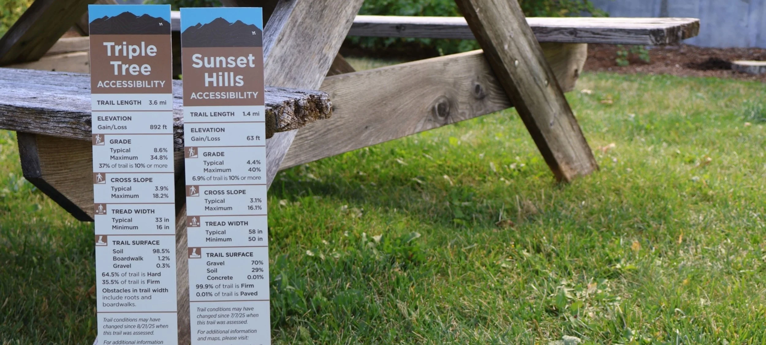
Some of you may remember that during the summer of 2025, our team mapped over 30 miles of local trails in Bozeman to collect comprehensive accessibility data.
GVLT’s 2025 Big Sky Watershed Corps member, Gil Thorp, spent countless hours wheeling our High Efficiency Trail Assessment Process (HETAP) machine—a unique device that looks a bit like a sturdy baby stroller—across local terrain. Through Gil’s hard work, the HETAP machine captured critical data on trail distance, grade, cross slope, tread width, and surface materials.
Find Accessibility Maps Online
We are excited to announce that this detailed trail data is now available on our website.
Whether you’re planning ahead or looking for specific conditions, visit the Featured Trails page on our website. Click on Accessibility Information to find links to maps detailing grade, tread width, and cross slope for the following popular trails:
Bozeman Pond Park
Burke Park (Peets Hill)
Gallagator Trail
Glen Lake Rotary Park
Highland Glen
Painted Hills
Path to the M
Snowfill Recreation Area
Sunset Hills and Softball Complex
Triple Tree
Coming Soon to Trailheads
In addition to our online maps, you will soon see detailed accessibility signage posted directly at trailheads for:
Highland Glen
Painted Hills
Sunset Hills and Softball Complex
Triple Tree
A Team Effort with MSU
GVLT often has the privilege of collaborating with local students, and last spring was no exception.
Students in Montana State University’s Geographic Information Systems (GIS) Capstone course, taught by Jackson Rose, selected GVLT as a community partner for group projects. One student team worked alongside our Trails team to create a rich story map detailing the history and evolution of Bozeman’s trail network. We were so impressed by their work that we brought on one of the students, Cameron Panjabi, as a summer intern. Using his GIS skills, Cameron created the accessibility maps now featured on our website.
“Working on this trail accessibility project was an amazing experience, and it felt rewarding to be working on something for the Bozeman community,” shared Cameron. “I hope these maps help people get outside more and enjoy what GVLT works so hard to protect.”
Why This Matters
GVLT Trails Director Matt Parsons explains, “Our goal is to empower every trail user to make informed choices—whether you're searching for an accessible route, navigating with a mobility aid, or just trying to avoid an unexpected steep climb.”
This project follows our recent launch of the all-abilities trails at Sunset Hills and the Softball Complex. By gathering HETAP data, we can now provide accurate details for people using adaptive mountain bikes, wheelchairs, or other mobility devices, as well as families with strollers or bike trailers. Knowing exact trail widths and surface textures helps ensure everyone can hit the trails with confidence.
Smarter Trail Stewardship
This data isn't just for trail visitors—it’s a powerful tool for maintenance, too. The HETAP device helped pinpoint maintenance needs, including:
Severe dips and erosion points
Social trails requiring revegetation
Narrow trail sections in need of widening
With these insights, our Trails team can craft targeted, proactive maintenance plans for the upcoming season.
In fact, our team was so pleased with the data captured and the many ways of employing it that we shared the HETAP machine with our peers in Helena at the Prickly Pear Land Trust.