On the Trail With Dayle: Seeing the Unexpected on Local trails
When I decided to walk the nearly 100 miles of Bozeman’s Main Street to the Mountain system (#BozemanM2M), I was woefully unaware of the extent of the trails and where they might take me in 2026. Sure, I was very familiar with the well-known trails—like Peets Hill, Story Mill Spur, Drinking Horse, and the Gallagator. And I knew that there were ponds at Gallatin County Regional Park and Cherry River, but I had never heard of Bronken Park or Cattail Lake.
Now I can count at least ten bodies of water on the Main Street to Mountains Trail Map. I also learned that Bronken Park and the Adam Bronken Memorial Soccer Complex honor the life of a 14-year-old Bozeman boy who was the victim of an accidental drowning in 1997. Adam, who had juvenile onset-diabetes, had spent his whole life in Bozeman and was active in raising funds for local diabetes programs. The park includes both wild-ish wetlands and a developed playground area—and appears to be still under construction.
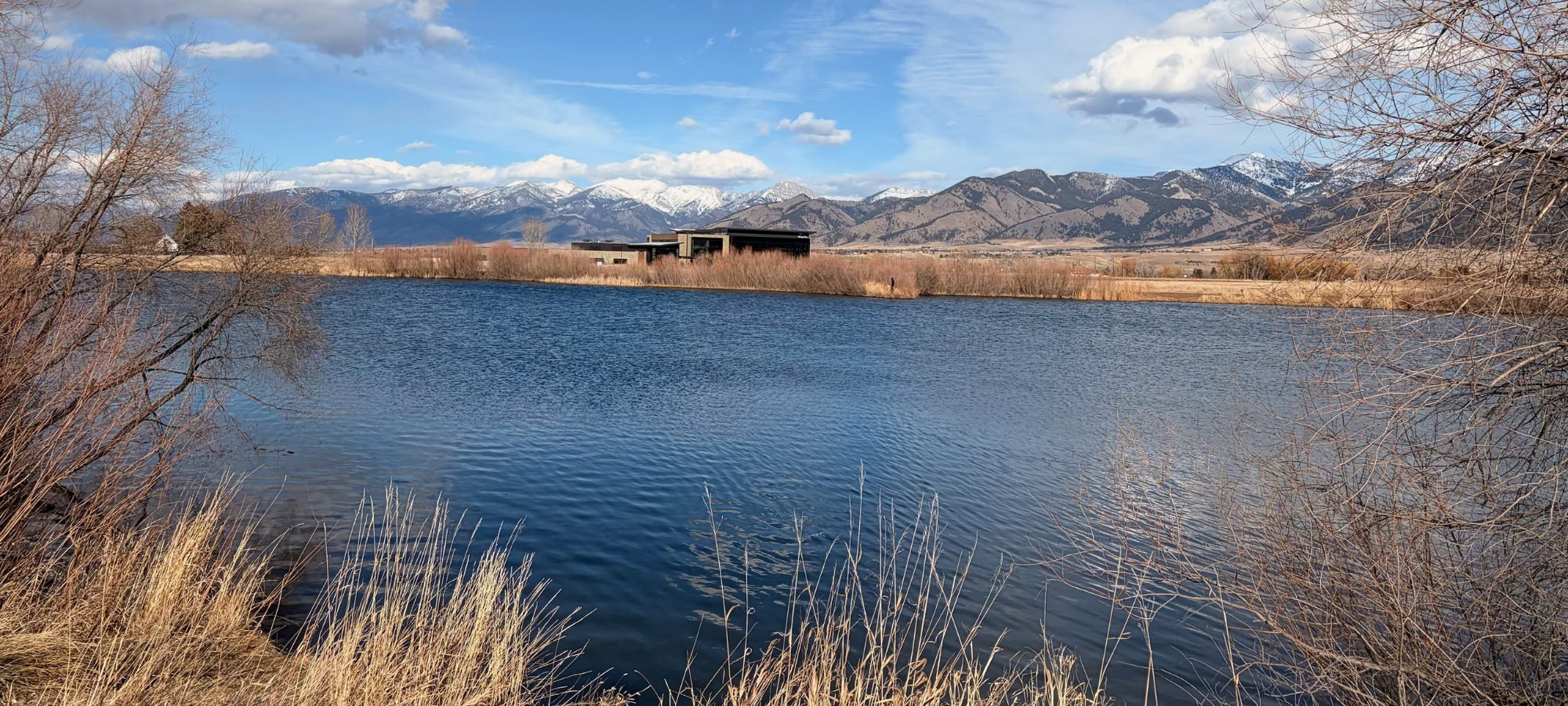
On a blustery February 16, I walked around Cattail Lake with incredible views of the Bridgers. The lake, about 10.66 acres in size, is appropriately surrounded by cattails and willows. While it is only a three-minute drive from I-90, walkers cannot see or hear the traffic. The Bozeman residents whom I have asked about the pond and park have also never seen or heard of it. Cattail Lake is reputed to have rainbow trout, and there were several fishermen trying their luck from the banks. I did not see any fish, kayaks, or evidence of the skating oval that is reported to exist during “normal” winter weather.
Our recent abnormally warm weather has been a bonus for trail exploration. I am, of course, worried about our mountain snowpack and the coming fire season. However, the more developed trails—gravel or shared-use paved pathways—have been dry and very walkable. Those trails with a dirt base, like Cattail Lake and Highland Glen, have many icy puddles that turn to mud on warmer days. During mud season, it’s incredibly important to “Hike Kind” and “Bike Kind” for both personal safety and trail maintenance.
So far, I think I have walked about 18 miles of the #BozemanM2M, but it is impossible to be precise. My estimated mileage is based on my iPhone miles/steps recordings and the mileage listed on the current GVLT map, which, I recently learned, is in the process of being updated. GVLT Trails Director Matt Parsons has explained to me that new trail sections are added as new developments extend throughout the city and county, creating an ever-growing and increasingly connected trail system.
I am working on a spreadsheet (to be shared in the future) of my 2026 trail adventures. I’m devoting columns to note start and finish locations as well as parking, estimated mileage, trail conditions, special views, and unexpected sightings. To date, these have included a Little Library only accessible by trail, a decorated “Treats for Trail Dogs” box at an in-town trailhead, and a beautiful pregnancy photo shoot with the Bridgers as a backdrop at Cherry River. The camera person and partner were bundled up for the wintry afternoon, while the mother-to-be wore a gorgeous emerald-green dress with no jacket or hat. I am always grateful to see such diverse uses of the Bozeman trails and try to record photographic proof when it is appropriate and not too intrusive.
Next month, I hope to meet with City of Bozeman staff who work on trails. The city is one of GVLT’s key partners, and I’m eager to learn more about the city’s process of maintaining and expanding trails. While I care deeply about the trails that I walk now, I am even more committed to trails for future generations and look forward to hearing about the city’s plans.